Events
How W+K and Ford Took Street View Off-Road
Putting America’s longest trail online with Google Maps
With the launch of “Ready Set Ford,” its first global platform in over 15 years, the automaker was looking for ways to show people they’re more capable than they think. And beyond just showing, they wanted to lean into the lifestyles of drivers, giving them more tools to confidently explore new places.
While the W+K team was ideating, we kept going back to one of our favorite places to visit: Street View. It’s pretty amazing how you can drop down almost anywhere and explore the terrain without actually being there.
What if that kind of extensive coverage existed for America’s 4×4 trails? What if Ford partnered with Google Maps and used some of their most capable vehicles to take Street View way off-road?
Our research led us to the TransAmerica Trail.
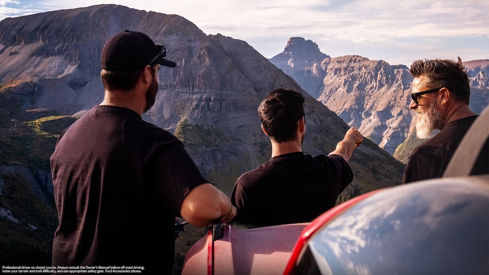
Typically navigated with roll charts, the route is a network of back roads and dirt trails that spans 5,900+ miles across 13 states and covers all kinds of rugged territory. It felt like the perfect way to highlight Ford’s off-road capabilities and push the limits of Street View.
Ford was in. Google Maps was in. So, we put together a team of drivers, filmmakers, W+Kers and a wilderness medic to venture off-road.
Led by a Ford Bronco with a Street View camera on top, our convoy spent 32 days traveling from the coast of Oregon to the coast of North Carolina, capturing imagery the entire way. (We also had a few dedicated shoot days mixed in with the support of a full production team.)
Throughout the journey, there were plenty of unknowns to navigate, including: How do we navigate this trail? Where do we stay at night? And what happens when we inevitably run into roadblocks?
Every day was exciting. The length, remoteness, and unpredictability of the trail all made it a uniquely challenging production. We truly never knew what was going to be around the next winding bend.
Our producer put together an incredible packing list (shoutout Marieme!) that included tents, inflatable sleeping pads, head lamps, water filters, bug spray and bear spray. We were prepared to camp on the side of the trail, and we did so a handful of times. We also stayed in many small-town motels.
The team quickly bonded and adapted. We basically lived in our Ford vehicles. For meals, we subsisted on freeze-dried meals and gas station snacks. We had to reroute around a giant sinkhole, fire closures and flood closures. We crept to the top of some intimidating Colorado mountain passes via old mining roads.
In between all the unexpected moments, there were also some planned ones. As we were capturing the journey, we staged a few Easter eggs for people to discover as they’re exploring Street View.
You can spot Sasquatch hiding in the brush in Utah, Colorado, and Mississippi (inspired by the Bronco we drove, which was equipped with an available Sasquatch Package).
We also invited our favorite GeoGuessr player, Georainbolt, to meet us in Utah. We found a great rock for him to hang on while our Ford convoy drove by.
In many ways, this journey was a 32-day shoot where the camera was always rolling. Everything we encountered across the country—from the beautiful to the treacherous to the bizarre—was captured by the Bronco and has been uploaded for anyone to explore from anywhere.
As an agency, it’s been rewarding to be part of creating something that’s more than just an ad, but also a legitimate off-road resource that will live on the internet forever.
If you want to plan a trip of your own, or simply click your way across America on dirt roads, search “TransAmerica Trail” on Google Maps.
The trail is worth exploring for yourself, whether in person, or now via Street View.